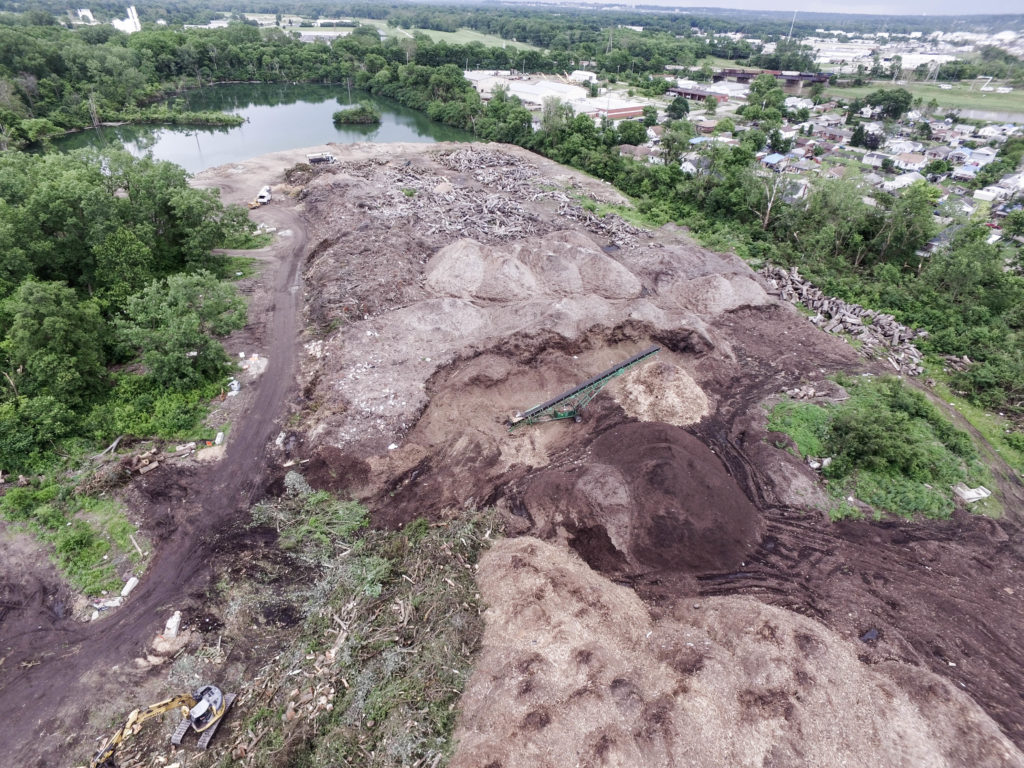
Incorporating aerial photography into any construction projects allows contractors to get a current up-to-date information on construction progress. This will allow a better management of resources, reduce downtime, and increase work site efficiency. Using 2D/3D mapping on any project will generate an aerial model that will allow for accurate measuring, real time obstacles and any dangers that may be present.
Another use of the mapping is to be able to measure the structure or any area from your computer. This will help reduce the time it would take for a person to measure an area. Doing so, will save man power and money.
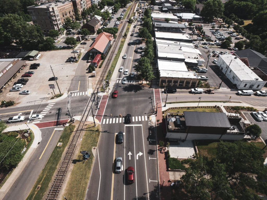
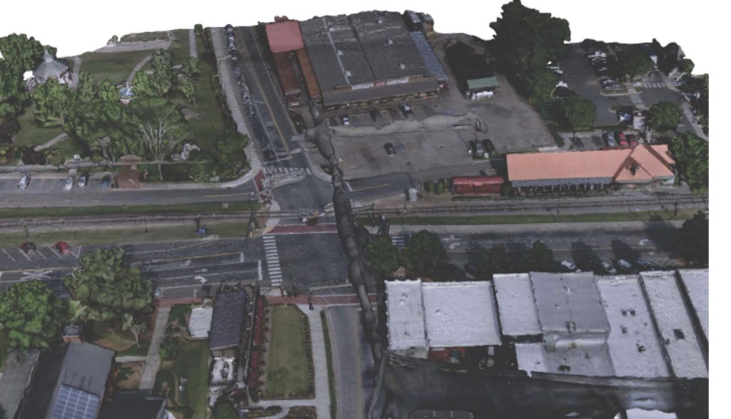
Below is an aerial photo of an intersection that is to be repaved. Get real time and accurate measurements. Normally it takes a few weeks to get accurate measurements and photos of an intersection and .50 mile of a street. This is costly and time consuming. Fly N High Media can cut that time and cost in half. We take our Drones and ground cameras to the location and can film, photograph, and map the area in no time. Once we have captured the footage, we go back to our office and process all the footage. We also work with Auto Cad and can send all the mapping in auto cad. Below is a photo of the same intersection as the 3D Mapping.
Our 2D and 3D models open up endless possibilities for your business and your clients by allowing them to virtually tour the construction site from anywhere in the world to get a visual progress report, calculate raw materials on a construction site, or easily conduct inspections over difficult terrain – all from a computer, smart phone, and tablet.
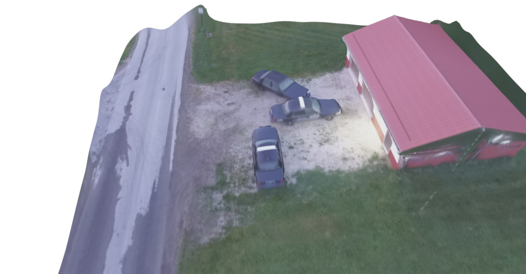
Having a paving company conduct paving and construction company Let us go out before your crews head to that location. We can not only take Aerial Photography / Videography, but we can even give you a 3D model of that area. We all know having a truck strike any live wires would cause an expensive delay.